All armchair travellers love maps. Even many of us who once in a while also get out and about love them. Maps are where you start when you’re planning your next trip. Or where you can go to revisit one of those journeys you made ten or twenty years ago.
Google Maps and maps on paper
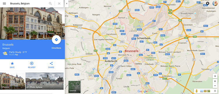
With the coming of Google Maps and Street View the armchair traveller has been given an enormous boon. When Mrs SC and I were looking for a place to live in Brussels, we used a property website in conjunction with Google Maps to get a grip on where in Brussels the places we were interested in were to be found, and then used Street View to look around the neighbourhood. Of course it doesn’t fully take the place of seeing the street, the architecture or the population density in real life. Or hearing the noises or smelling the air for that matter. But it does give a much better idea than a paper map.
At the same time, while I can appreciate the advantages of an electronic map, I still feel there’s nothing quite like a real map, printed on paper, that you can carry with you. As we did when we travelled to Brussels recently. You can mark a paper map in a way you can’t mark an electronic map. You can stick post-its on it. Use it as a signalling device to attract your partner or the help of random passers-by. Shelter under it in an unexpected shower. And (if it hasn’t dissolved) you can keep it as a souvenir of your adventures.
Maps of inspiration
Travel books and adventure stories – not to mention accounts of fantasy worlds – are complemented and completed by maps. Following the journey of Marco Polo to China and back is made easier with a map. Tracing the voyages of the Vikings and the route of Fletcher Christian and the Bounty mutineers across the seas of the world likewise. And what would Bilbo’s journey to the Misty Mountains – or Frodo’s quest to Mount Doom – be without Tolkien’s spidery maps and dodgy calligraphy? What would Narnia or Earthsea or Westeros be without their maps?
And maps are also handy ways to convey information graphically, whether it’s true information or invented – or an amalgamation of the two.
Strange Maps
I love maps, and I love the inventiveness of cartographers and that makes the blog Strange Maps: An Atlas of Cartographic Curiosities, created, composed and curated by Frank Jacobs, a pleasure to visit. I don’t know how long he’s been publishing the blog, but the most recent article (Watercolours of the War between East and West) is number 746 so it’s certainly been going a while. It’s not a weekly thing, but every so often I take myself there and I binge. I usually read the current post and then follow the links to other related – or often unrelated – posts. Sometimes I’m intrigued enough to go and visit the sources, which Frank Jacobs is always careful to include.
For example, this time around I followed “related links” to read about the Circular Towns of Georgia (in the USA), Planet Voronoi (where the countries of our world have mysteriously changed shape “patterned after some abstruse logic”), Nazi Treasure Maps and Phallic Cartography. Many of the more recent articles have internal links to earlier articles which can also be great fun to follow. The Nazi Treasure Map article links to blog entry 63 – The Lost Dutchman Goldmine – and to entry 88 – Neuschwabenland. (Sadly though some of the internal links seem to be broken or blocked. Number 234 Slumless, smokeless cities, for example, which has a link from the Circular Towns article, comes back empty for me. A pity.)
But generally this is a very good website and well worth a visit. Or three.
His excuses
I am myself out travelling at present, which is why this week’s effort is so short. I’m hoping to return to my regular service next Wednesday.
Toodle-pip!
I’m also publishing this article for the #Blogg52 challenge.
I also love maps. My daughter is all GPS. But you cannot travel on the GPS. You can only get to a destination. That is quite a difference. I keep old maps, they have the World as it looked on that time (good or bad) and they still have the marks from my pen, the travels I made or planned to make. They have a history and a memory.
I love the distinction you make between maps and GPS, Eva. I think I might steal it!
:-9
We have a couple of file boxes with old maps – street maps, public transport maps, walking maps. As you say, they have histories and memories. We have a street map of Sofia from 1982-83 when we lived in Bulgaria which we hoicked out when a young Bulgarian colleague of Mrs SC’s came for a meal. He was fascinated by the street names, most of which have have been called something quite different in his lifetime.
Maps my God! I’m so bad at reading it. But without it I’m totally lost. That’s me!
You seem to be quite good at maps.
I havent travelled that’s much in my life yet. But I’m hoping I will when I get older.
Maybe I have to practise reading maps then …
When I was 13, I think, we studied map reading as part of geography at school and then got taken into the countryside and left in groups of four with a map and a compass to find our way to a pick-up point. It was a lot of fun, we even managed to read the map successfully enough to find our way where we were supposed to (eventually). I’ve been an advocate of map-reading in the school curriculum since then. On the other hand, my eyesight now is so bad I can’t switch from looking at the map to looking at the real world very fast, so opening a map while out and about is more a body-language cry for help from friendly passers-by. It works too!